Antarctica, Argentina, Uruguay, and Brazil
Southbound Again, to Ushuaia and Tierra del Fuego
Absurdly early the next morning, we left Buenos Aires on our charter flight south to Ushuaia, the jumping off point for our voyage to Antarctica. But before boarding our ship, we had the opportunity to visit the magnificent Tierra del Fuego at the far southern tip of Argentina.
Here are some photos:

Our Sail with Seth group met in the hotel lobby at 3:25 am. Yes, that was gawdawful early! We needed to do that to get to our 6:00 am flight out of Buenos Aires. Ugh. It was not up to us, or even Sail with Seth. The cruise line that we would be joining in Ushuaia had chartered our flight there, so it was the early bus ride to the airport and the 6:00 am flight, no choice. Ouch!
Our flight was on AlbaStar.es airlines. I had never heard of them (turns out they're a Spanish charter airline with all of 5 aircraft in their fleet). Our plane was a 22-year 737-800 in a maximum density configuration. To say it was uncomfortable is an understatement. It was simply the worst flight I have taken in years. It was so cramped that I couldn't reach my small euro-legal personal-item-sized backpack under the seat in front of me. There was no room. My knees were flush against the seat in front of me and my feet were all but pinned—I just could not move. The flight was 3 hours in a straightjacket. Simply awful!

Ushuaia is a small city on the famous island of Tierra del Fuego ("Land of Fire" in English). Before we headed to the ship, we spent a few hours visiting Argentina's Tierra del Fuego National Park.
The Andes mountains run the entire north-south length of South America. At their very southern end, they curl to the east, so the mountains run east-west in Tierra del Fuego. The island is divided between Argentina and Chile, Argentina possessing the northern and eastern portion of the island, while Chile possesses the southern and western portion.
Here you can see the Andes in Tierra del Fuego. They are not anywhere near as high as the Andes I crossed earlier in this trip—the highest peak in the Argentinian side of Tierra del Fuego is only 4888 feet high, but they are still very rugged mountains.

Bahía Lapataia is a small inlet off the Beagle Channel. The Beagle Channel is a narrow protected waterway that allows vessels to pass from the Atlantic to the Pacific, and vice-versa, provided they are small enough to fit. Larger boats, like tankers and most container ships, have to go around Cape Horn and suffer the high seas of the Drake Passage.
Bahía Lapataia is an excellent venue to observe sea birds and other wildlife. Its main claim to fame, though, is that it is the southern terminus of the Panamerican Highway.

The birds in this photo are all Kelp Geese. At first I thought there were two species of geese in this picture, but they are all the same species. The sexes of Kelp Geese have completely different appearances. It's common for male and female geese to be substantially different in size, and that is true in Kelp Geese, but usually geese plumage is very similar or identical for both sexes. In Kelp Geese, though, the males are snow white with black bills and the females are brownish above and black-striped on the sides and have pink bills. The Kelp Geese get their name, unsurprisingly, because the staple of their diet is kelp. Kelp Geese exist only in far southern South America, primarily in Tierra del Fuego and the Chilean Fjordlands. There is a closely related subspecies of Kelp Geese that exists only in Falkland Islands.
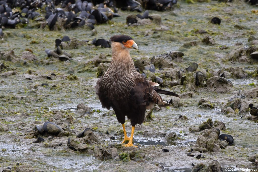
This handsome bird is a male crested caracara. The crested caracara is a raptor related to the falcon. It natural range is nearly everywhere in the Americas and the Caribbean from the US Southwest to as far south as Tierra del Fuego. It was low tide when I visited Bahía Lapataia and this guy came strutting through the exposed tideland looking for a snack.
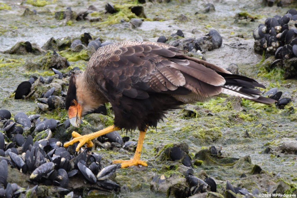
There were lots of mussels exposed on the tideland and that presented an opportunity to the caracara. He tugged repeatedly on the mussels, looking for one to break free.

Success! He finally found one and got his snack.
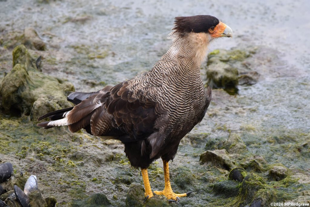
The caracara, after having his short meal, continued his strut closer to where I was. There's something about the way this caracara walked that said, "I'm the biggest, baddest thing on this beach, look out for me!" He stopped briefly, near enough to me that I could snap his portrait.

The border between Argentina and Chile runs down the middle of the Beagle Channel. I took this photo from Ensenada Beach in Argentina's Tierra del Fuego National Park. The island in the foreground is in Argentina, the mountains in the background are in Chile.
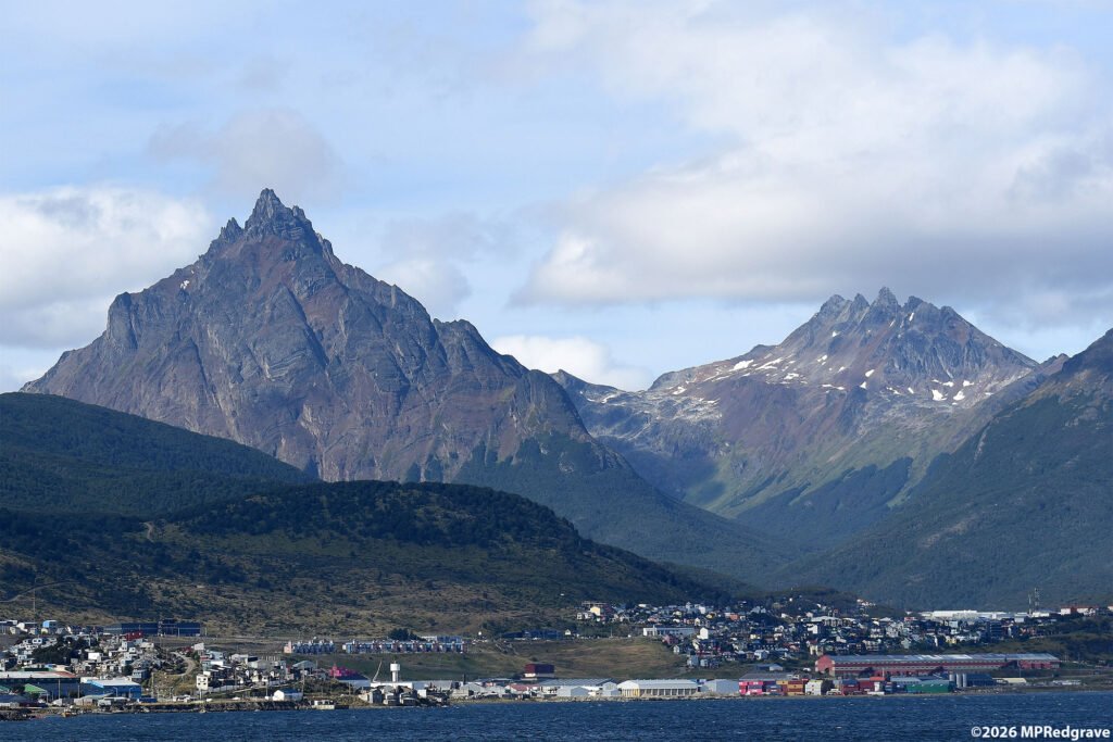
While the Andes in Tierra del Fuego may not be that high, they are still steep and rugged and they rise almost directly out of the sea. The mountain on the left is Monte Olivia at 4350 feet, and the jagged, toothed mountain on the right is Los 5 Hermanos (The 5 Brothers) at 4200 feet. The city is the foreground is part of Ushuaia.
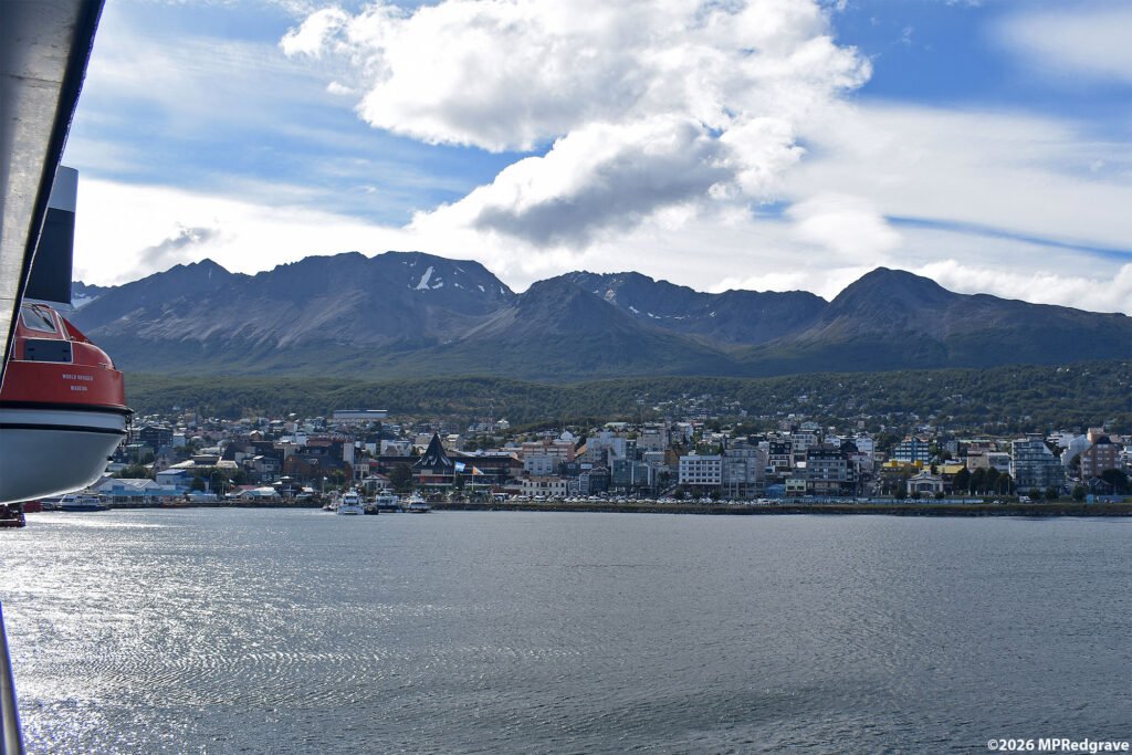
After our visit to Tierra del Fuego National Park and a good lunch at a restaurant in Ushuaia, we boarded the World Voyager for our adventure to points south.