Antarctica, Argentina, Uruguay, and Brazil
Colonia del Sacramento, Uruguay
The next day of my adventure, I traveled across the Río de la Plata to visit Colonia del Sacramento in Uruguay. The Río de la Plata ("Silver River" in English), while called a "river," is actually an estuary. The Paraná (South America's 2nd longest river, after the Amazon) and Uruguay rivers empty their fresh water and their sediment at the far west end of the Río de la Plata. At that point, and for the next 60 km or so, the Río is 50 km (30 miles) across, but widens and deepens easterly until it reaches the Atlantic Ocean, at which point it is some 220 km (call it 135 miles) wide. The locals like to claim the river as the widest in the world. You kinda have to take that with a smile and a grain of salt. It's really a very large bay with two very large rivers at its western end that have enough flow to keep the water in the Río from becoming noticeably brackish until near the Atlantic.
After being processed through Argentine and Uruguayan immigration, I boarded a ferry that crossed the Río and took me to Colonia del Sacramento. Colonia has a fascinating history. I'll give you the Clif Notes version. In 1494, Spain and Portugal agreed to the Treaty of Tordesillas that drew a north-south line through South America, where Spain got everything to the west of the line and Portugal got everything to the east of the line. It turns out that that line runs right through the middle of present day Uruguay. Colonia is just to the west of the line, so Spanish, right? Well, Colonia was founded in 1680 by the Portuguese. Spain took exception. Several skirmishes ensued over the next 150 years where the two countries repeatedly took control of Colonia from the other. This went on until Uruguay formally became an independent nation in 1828.
As a result, Colonia shows both Spanish and Portuguese influences. To this day, many residents of Colonia identify as Spanish or Portuguese. To a visitor like me, after being educated my our excellent guide Lourdes, what I noticed most were the differences in Portuguese and Spanish architecture, the layout and uses of the town's central plaza, and notably the city's wall. I'll explain more in the photo captions.
That said, here are some photos:
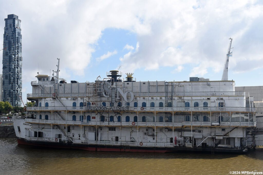
This old Mississippi riverboat was tied up across the harbor in Buenos Aires from where the ferry to Colonia docked. Why, you may ask, is there an American riverboat in Buenos Aires harbor? The answer, believe or not, is politics. In 1999, a Spanish gaming company wanted to set up a casino somewhere in downtown Buenos Aires. They ran into a seemingly impenetrable roadblock—the city of Buenos Aires strictly prohibits gambling. They could not build a casino inside the city. What they found, though, is that the water in the harbor is not within the city, but falls instead under Argentine national jurisdiction. As long as the casinos are afloat in the harbor, they are legal. As a result, the Spanish gaming company purchased the dock space from the city and parked two riverboats backend-to-backend next to that dock space. They converted those boats to casinos and permanently attached them to the shore, but they are afloat in national territory, so all is legal.
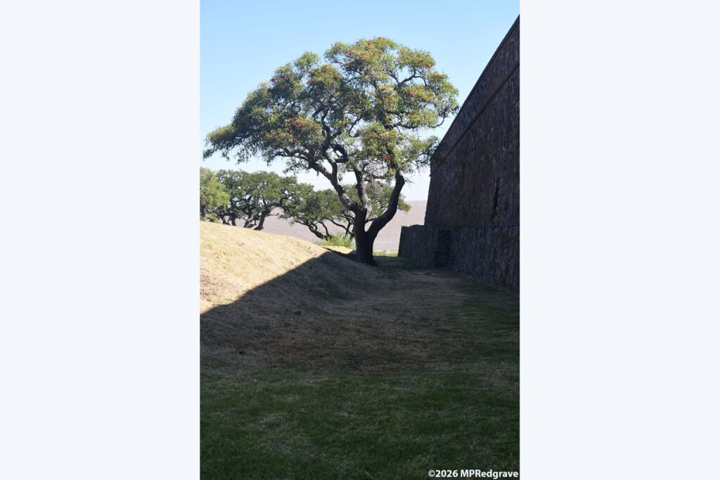
In Colonia, the original Portuguese town—the Barrio Histórico, a UNESCO World Heritage Site—sits on the end of a small peninsula. Tired of nearly continuous attacks from the Spanish, the Portuguese built this wall that effectively sealed off land access to the Barrio. What you see here is the Spanish side of the wall, where the stone wall rises nearly vertically to its full height. By the way, the tree you see growing next to the wall is a Ceibo tree, the national tree of Uruguay. The tree's bright red flower is the national flower of Uruguay.

On the Portuguese side of the wall, the builders created a soil embankment that allowed the Portuguese soldiers to easily see over the wall. The building in this photo is probably an old Portuguese building modified and painted to look more Spanish.

The Plaza Mayor was the center of life in the old Barrio Histórico. Today it is a relaxing tree-lined square that one can use to sit in the shade and eat your chivito (the national dish of Uruguay) and listen to the live music. Back when the Portuguese and the Spanish were disputing ownership of Colonia, the Plaza was anything but peaceful. It was an open treeless space that military leaders used to drill their soldiers to prepare for the next battle!

The Barrio Histórico's peninsula juts into the Río and continues underwater for some distance offshore. Many a ship wrecked on those rocks. In the 1860's, the Uruguayan government built this lighthouse, known simply as the "Faro" ("lighthouse" in Spanish) to help prevent the shipwrecks. It stands 88 feet tall and is open to the public, at least those crazy enough to crawl up its very steep spiral stairs and ladders. Sounds like something I might do!

The Faro was built on the foundation of a ruined Portuguese convent that burned down in the early 1700s and was never rebuilt. Apparently that foundation was so stout that it easily supported the weight of the lighthouse. The building on the right is an original Portuguese building, with the characteristic thick walls, small windows, and shallow tiled roof. It is also painted in traditional Portuguese "Sangue de Touro", literally Bull's Blood, though its color was derived from a local root and contained no blood.
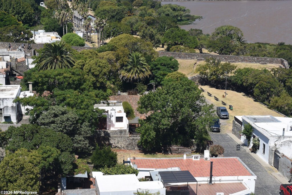
From the top of the Faro (yes, I did climb up there!), you can see the Portuguese side of the wall.

Seen from the top of the Faro, this is the Plaza Mayor, about 3:30 in the afternoon after the lunch crowd had mostly left.

Until about 100 years ago, one could not see Buenos Aires from Colonia. Before then, the tallest buildings in Buenos Aires simply weren't tall enough to be seen over the Earth's curvature. Now, though, there are thousands of highrises in Buenos Aires that stand tall enough to be seen 50 km away in Colonia, at least from the top of the Faro. This view is from there, which got me just high enough to see the taller buildings in Bueno Aires. From ground level, all I could see were just a few barely noticeable bumps peeking above the horizon.